About Natural Climate Solutions
IN THIS MODULE
You will learn about:
Forests, Wetlands, Peatlands, Grasslands and agricultural lands
Permafrost
Blue carbon
Case studies for each ecosystem
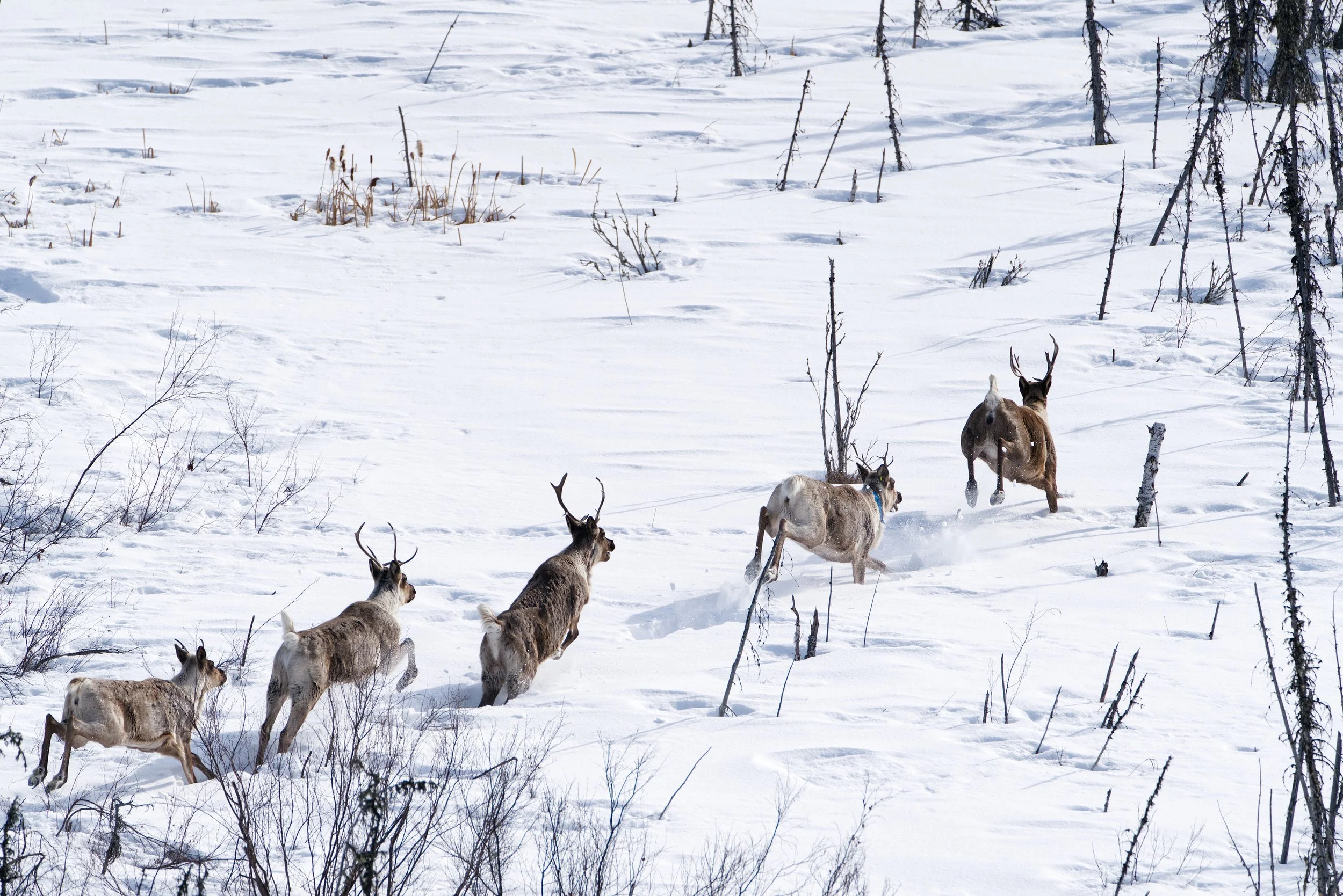
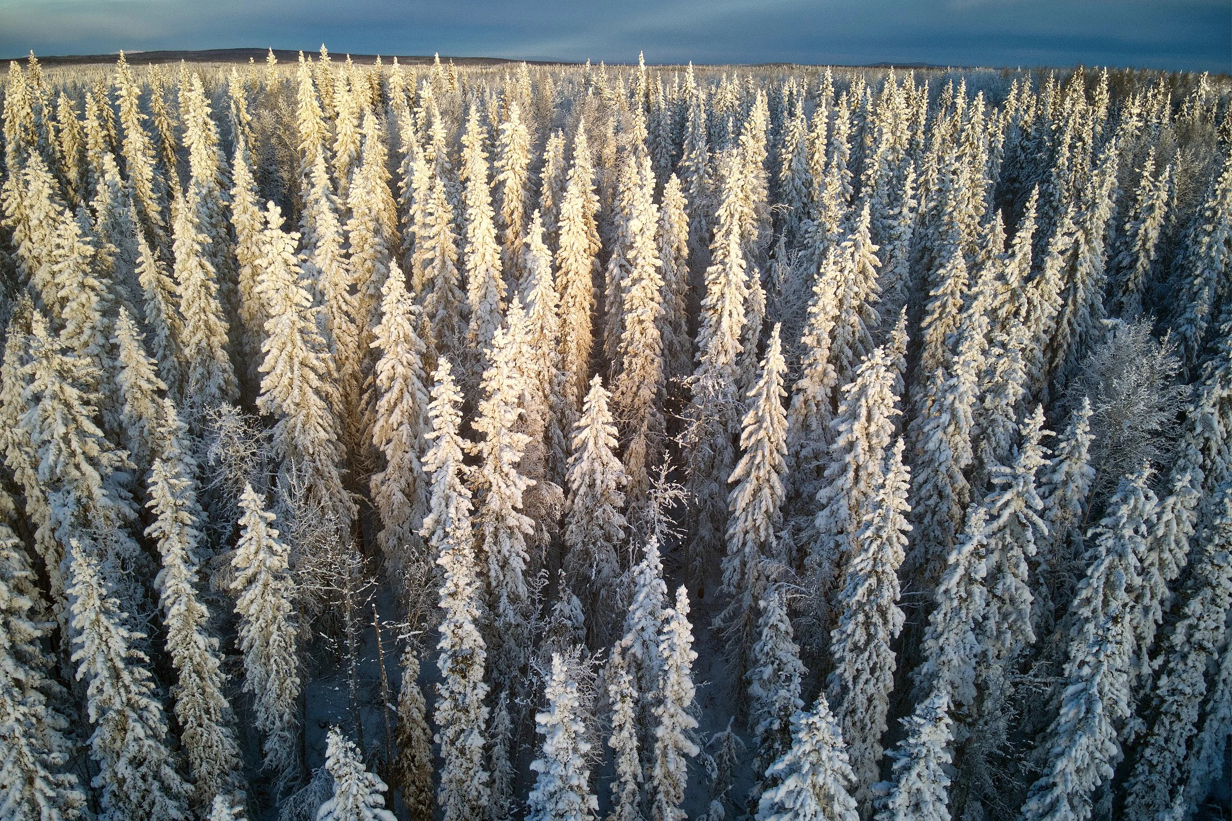
Natural climate solutions by ecosystem
Forests are places where trees dominate. Carbon is stored in forest soils, living and dead trees, understory plants, and leaf litter. Some people also consider plantations, places that have been logged and replanted by humans, to be forests.
Boreal forests constitute about one-third of Earth’s forests and cover much of Canada. The boreal contains about one-third of the Earth’s terrestrial carbon stocks. [31] Temperate rainforests, which also exist in Canada, store very high levels of carbon.
Primary forests are forests that have never been industrially logged and are typically more carbon-dense than previously logged forests [32]. Primary and ecologically mature forests typically harbour higher biodiversity than industrially modified forests [33], especially in the understory. Primary and ecologically older forests have the highest carbon stocks compared to secondary, degraded, intensively managed, or plantation forests [34].
When a primary forest is logged, much of the stored carbon is lost to the atmosphere right away. [35]
All boreal and temperate primary forests undergo cycles of natural disturbance processes such as fire, insect outbreaks, and disease, which are important ecologically and create habitat for wildlife through the creation of dead trees. Primary forests recover from these critical processes on their own and do not require logging or replanting.
Boreal forests managed for timber are kept young, and the logging machinery, changes in tree species, and disruption to the forest floor means these soils store far less carbon than they otherwise would. [36] Even outside the boreal, soil holds a significant share of a forest's total carbon — and logging depletes it through compacted and disturbed soils, erosion, changes in temperature and moisture that cause carbon to be released faster, and the loss of leaf litter, roots, fungal networks, and the burning of post-logging debris. [37]
In boreal forests, especially those with poor drainage, most carbon is stored in dead plant material, peat, and organic soil layers that build up slowly over centuries, often protected in place by permafrost. [38].
A visual comparison between a primary forest and a replanted landscape, and the rate of carbon storage
Forest
Case study
Improved Forest Management and establishing a protected area
his is a hypothetical case study developed for illustrative purposes. Any resemblance to real groups, organizations, or situations is purely coincidental.
First Nation W’s traditional territory is 340,000 hectares and contains both primary forest and plantation forest that was harvested around 60 years ago. Two logging companies operate in the area, one of which is owned by the Nation. Nation W relies on revenue from logging to support several health and wellness programs.
Nation W has an existing land use plan that outlines top community priorities, which are: to safeguard areas of cultural significance and to protect some remaining primary forests within the territory, as they are the best moose habitat. Moose are an important local food source.
Areas of primary forest are scheduled to be logged in the coming years by the externally owned logging company. Nation W has a working relationship with this logging company and is in active negotiations to purchase part of the forest licence that is within their territory.
Nation W’s top priorities are to buy out the logging tenure held by the externally owned company, protect primary forests, and transition to logging the plantation forests to maintain revenue. First Nation W plans to raise funds to protect the culturally significant primary forest by establishing an Indigenous Protected and Conserved Area (IPCA) that prohibits logging. They also wish to buy out the forest tenure of the non-Nation-owned logging company to gain more control over logging in their territory.
Nation W is interested in exploring Improved Forest Management options in plantation forests to maintain revenue.
Activities:
Finalize negotiations with the external logging company
Buy out the forest licence
Create an IPCA to protect the primary forest
Improved Forest Management in the plantation
GHG benefit:
In a forest, CO₂ is absorbed and held in the above-ground and below-ground parts of trees and the soil. By protecting the primary forest in their territory, Nation W is avoiding releasing large amounts of carbon that would be lost if it were logged. By switching management from primary forest to plantation, Nation W is reducing its GHG impact.
Wetland
Wetlands are places where water meets land, and the land is saturated or covered with water most of the time, often fed by a lake, river, or groundwater. Specialized, water-loving plants (hydrophytes) and oxygen-limited soils develop in wetlands. Marshes and swamps are types of wetlands. Wetlands are harmed when they are drained or filled, or when the lands around them are changed in any way that affects their hydrology.
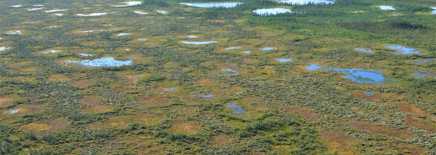
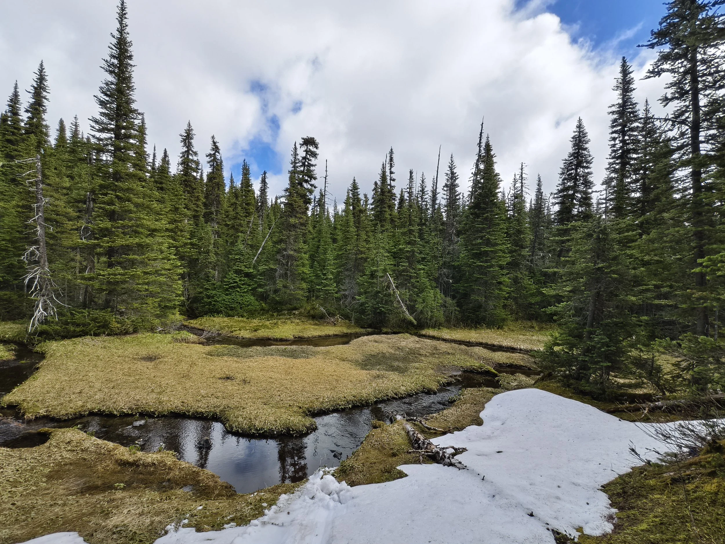
Photo credit: Caylin Sun
Case study
Restoration of a wetland
This is a hypothetical case study developed for illustrative purposes. Any resemblance to real groups, organizations, or situations is purely coincidental.
First Nation X’s traditional territory has been degraded by activities associated with oil and gas development. Elders remember a time when they lived off the land, eating fish from the lakes and finding moose in abundance. Now, the territory’s wetlands and forests have been fragmented by service roads and fracking wells. Wildlife populations have declined, and many of the community's traditional food sources are no longer safe for consumption due to high levels of pollution.
A decade ago, Nation X filed a lawsuit against the province for failure to uphold treaty rights. Nation X won the case, and much of the industrial activity harming part of their territory has ceased. Nation X is now looking to restore that part of their territory. Last year, Nation X updated their land-use plan, and a top priority is restoring a culturally significant 600-hectare wetland that was previously a traditional hunting ground for the Nation.
Nation X’s top priorities are to restore the wetland, increase food security, and to revitalize their connection to the land. First Nation X plans to raise funds to deactivate and decommission roads and drill areas around the wetlands. They also plan to start an Indigenous Guardian-led restoration program to remove invasive plant species and restore the area’s natural landforms and water flows so that native plant communities can thrive.
Activities:
Assess cumulative impacts in the area
Deactivate and decommission roads and well pads
Remove all invasive plant species
Restore the land’s natural shape and water flow
Create space and the conditions necessary for native plant communities to return
GHG benefit:
Wetlands are important ecosystems for carbon storage and sequestration. Through their restoration work, Nation X is returning the wetland to a carbon sink. After a few years, the wetland is starting to look more like it did before it was impacted by the oil and gas service roads. It is once again waterlogged, and the cattails and sedges are flourishing. Red-winged blackbirds call into the evening, and carbon storage capacity is slowly returning to the wetland as it recovers.
Photo credit: Wildlife conservation society Canada
Blue Carbon
Blue carbon is carbon stored in coastal and marine ecosystems, like mangroves, tidal marshes, and seagrass meadows. [48]
Coastal and marine ecosystems contain large stores of carbon. Often, the soils of blue carbon ecosystems are anaerobic, meaning they lack oxygen. This absence of oxygen causes the carbon within the soils to decompose very slowly, allowing it to be stored for thousands of years [49].
Grasslands and agricultural lands
Grasslands, sometimes called “plains” or “prairie,” are dominated by grass species. Natural grasslands store large amounts of carbon in their soil and root systems, which can be so deep and vast that they have been referred to as “upside-down forests.” [39] Most natural grasslands in Canada evolved with grazing bison and fire.
Natural grasslands suffer degradation from intensive agriculture, including plowing, planting, livestock grazing, and development. Occasionally, pasture areas (with non-native plants for grazing) or croplands (such as wheat fields) appear similar to natural grasslands but are not. Nonetheless, these agricultural lands also contribute to carbon storage.
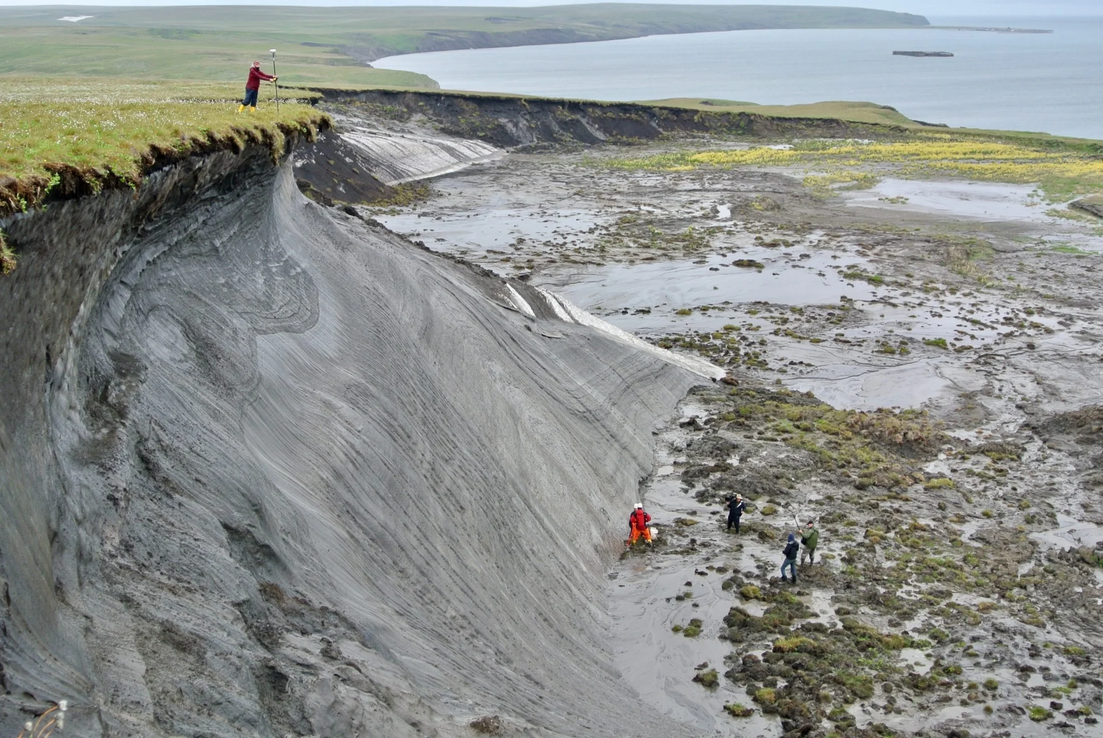
Photo credit: Boris Radosavljevic / Wikimedia Commons
Peatland
Peatlands, sometimes called bogs, are a type of wetland dominated by sphagnum mosses (peat). Peatlands are waterlogged and acidic environments where the microbes responsible for decomposition work very slowly, which leads to the accumulation of dead plants. The spongy layers of peat in a peatland can be metres deep. Peatlands are carbon storage powerhouses.
Draining, mining, or clearing a peatland releases large amounts of GHGs. When a peatland is degraded by these activities, restoration can begin by bringing back the water regime and encouraging the growth of peat mosses and other plants that comprise the local natural community.
Case study
Avoided conversion of a peatland
This hypothetical case study was developed for illustrative purposes. Any resemblance to real groups, organizations, or situations is purely coincidental.
First Nation Y is a fly-in community whose territory encompasses 200,000 square kilometres of untouched peatlands and boreal forest. The peatlands in Nation Y’s territory are home to hundreds of species of waterfowl, fish, caribou, and other important animals that have supported Nation Y’s community health and well-being since time immemorial. Elders have noticed a change in wildlife populations, and hunting is more difficult.
Fifteen years ago, mining exploration revealed there were large deposits of a precious metal within the territory. Last year, the mining lease holder announced they were considering beginning mining within a three-year period.
Nation Y is aware that mining in their territory would severely degrade the peatlands and have a detrimental effect on wildlife. They know that peatlands store significant amounts of carbon and are important for mitigating and adapting to climate change. The community is very concerned about the negative impacts of mining and feels responsible for protecting the land that sustains them.
Nation Y’s top priorities are to protect the wildlife that use the peatland, prevent current and future industrial development in the area, and safeguard cultural heritage. Nation Y has decided to raise funds to create an IPCA that encompasses the peatlands and permanently extinguish the mineral tenure within their IPCA.
Activities:
Buy out mineral tenure
Create IPCA
Create an Indigenous Guardian program to monitor IPCA
GHG benefit:
Mining generally requires the complete removal of surface vegetation and soils from the land. Mine service roads are typically much wider than standard service roads. By preventing mining activities in peatlands, Nation Y is avoiding a large amount of carbon from being released into the atmosphere from the disruption of organic soils and slow-growing trees.
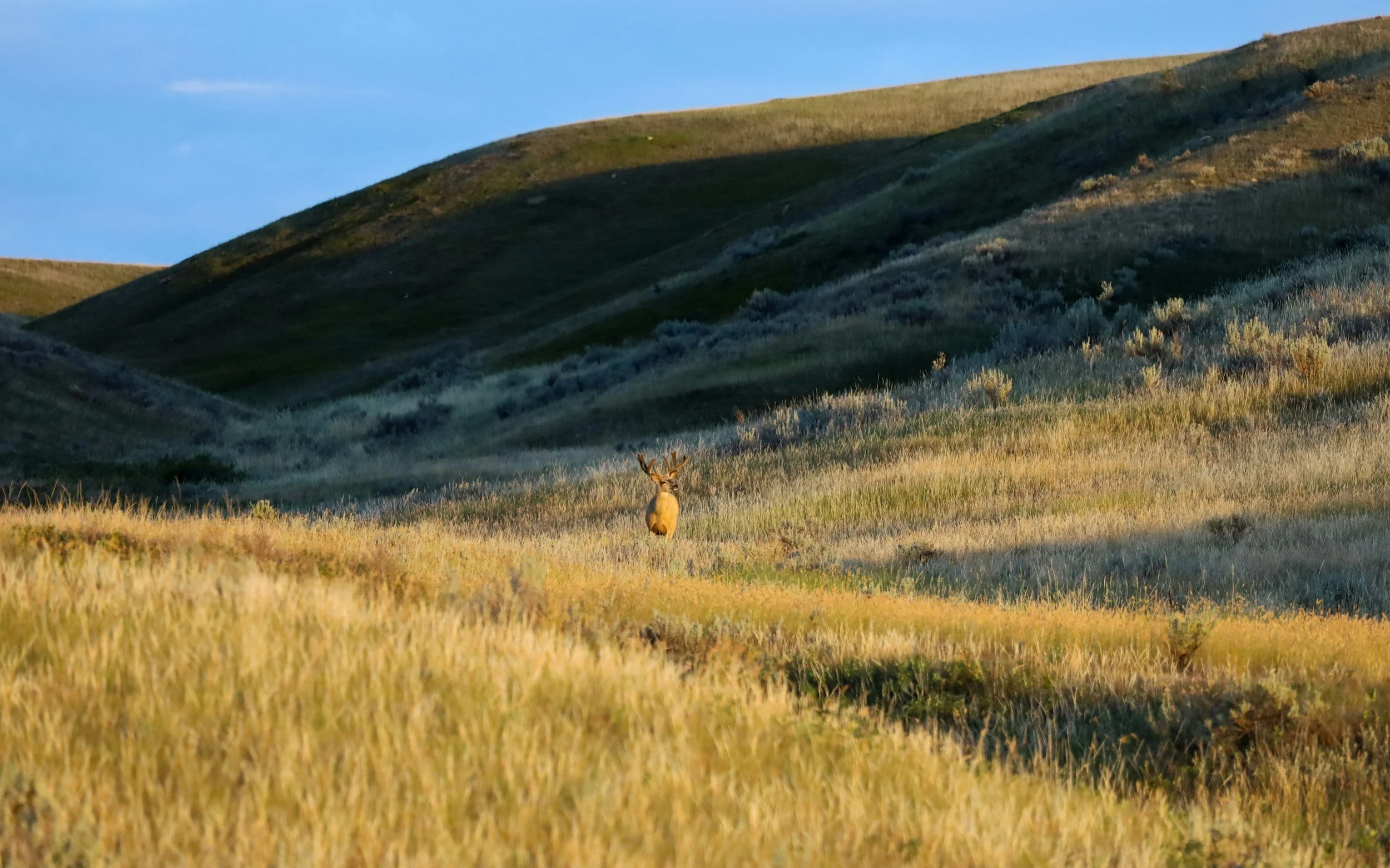
Photo credit: Andrew Darlington
Case study
Avoided conversion of a grassland
This hypothetical case study was developed for illustrative purposes. Any resemblance to real groups, organizations, or situations is purely coincidental.
First Nation Z’s traditional territory includes 1,000 hectares of native prairie grassland. This ecosystem is home to many species, including the chestnut-collared longspur and endangered ferruginous hawk. The grassland holds cultural significance for Nation Z, and community members actively use it for language camps, hunting, and medicine.
A portion of the grassland next to Nation Z’s reserve land is owned by several private landowners and sits among the headwaters of an important river basin. This area was historically used for ceremony, and Nation Z is interested in buying back the land from its current owners.
Recently, commercial real estate developers have targeted these lands and expressed interest in developing a commercial food lab and a large warehouse facility. In addition to the buildings, the development plans include the construction of several roads and power lines, posing a significant threat to these native grasslands.
Nation Z’s main priorities are to protect natural grasslands, prevent current and future industrial development, and secure land. Nation Z plans to raise funds to secure and protect the grassland ecosystem from commercial development. They are also interested in purchasing the private land adjacent to the reserve lands, and plan to include fee-simple land acquisition in their NSCSF proposal. Nation Z is currently engaged in a land-use planning process to examine the Nation’s long-term stewardship vision for the next decade.
Activities:
Acquire the private land
Create an IPCA
GHG benefit:
The soils and roots of grasses are where much of the carbon in grassland ecosystems is stored. By protecting native grassland from being cleared, Nation Z is avoiding the release of large amounts of carbon from this ecosystem and protecting the habitat of endangered species at the same time.
Permafrost
Permafrost is ground that remains frozen at or below 0°C for at least two years. [40] It is found in cold climates and at high altitudes, where the ground does not thaw completely, and it can range in thickness from less than 1 metre to over 1,500 metres. [41] A thin layer of soil, called the active layer, sits on top of the permafrost. [42] The active layer thaws in warmer summer months and refreezes when temperatures drop. Climate change is causing the active layer to thicken, leading to negative impacts on the atmosphere and environment. [43]
Carbon stored in permafrost is made up of the remnants of plants, animals, and microbes that lived and died in tundra and boreal ecosystems, accumulating in frozen soil over hundreds to thousands of years. [44] The northern permafrost region holds almost twice as much carbon as is currently in the atmosphere. [45] As the climate warms, resulting in increased permafrost thaw, excess carbon is released from once-frozen organic matter into the atmosphere.
Not only does thawing permafrost have negative consequences for GHG emissions, but it can also lead to coastal erosion, infrastructure loss, landslides, and ecosystem damage. [46]
Example
Edéhzhíe Dehcho Protected Area and National Wildlife Area
The Dehcho First Nations (DFN) are protecting 14,218 km² of ecologically and spiritually significant lands for future generations through the creation of the Edéhzhíe Protected Area. Edéhzhíe has served as a place for the communities of the Dehcho and Tłįcho Dene to gather food, heal and reconnect with the land. The area is natural, abundant, and home to a variety of wildlife, including birds, fish, caribou, bats, bison, frogs and insects.
The Edéhzhíe Protected Area includes the Xahndaa Deh (Willowlake Rıver), K’ázhíáh Deh (Horn River) and Gahdhı́ah (Rabbitskin River).
The Dehcho Collaborative on Permafrost, an initiative led by DFN in partnership with Scotty Creek Research Station, was established to lead development of adaptation and monitoring strategies rooted in both western sciences and Indigenous knowledge. [47]
In 2018, DFN declared Dehcho Protected Area under their own law. The Edéhzhı́e Agreement was signed with the Government of Canada, establishing a collaborative approach to co-management and monitoring Edéhzhíe. In 2020, the Government of the Northwest Territories committed to cease issuing any new subsurface resource rights in the region. In 2022, Edéhzhı́e became an ECCC National Wildlife Area under the Canada Wildlife Act.
For more information, refer to DFN’s Draft Edéhzhíe Management Plan.
For more information, refer to DFN’s webpage on Edéhzhíe.
Partners:
Dehcho First Nation
Tlı̨chǫ Government
Government of Northwest Territories
Academic institutes such as Wilfrid Laurier University, York University, and McGill University
Known Funder:
Government of Canada - Pathway to Canada Target 1 and Canada Nature Fund
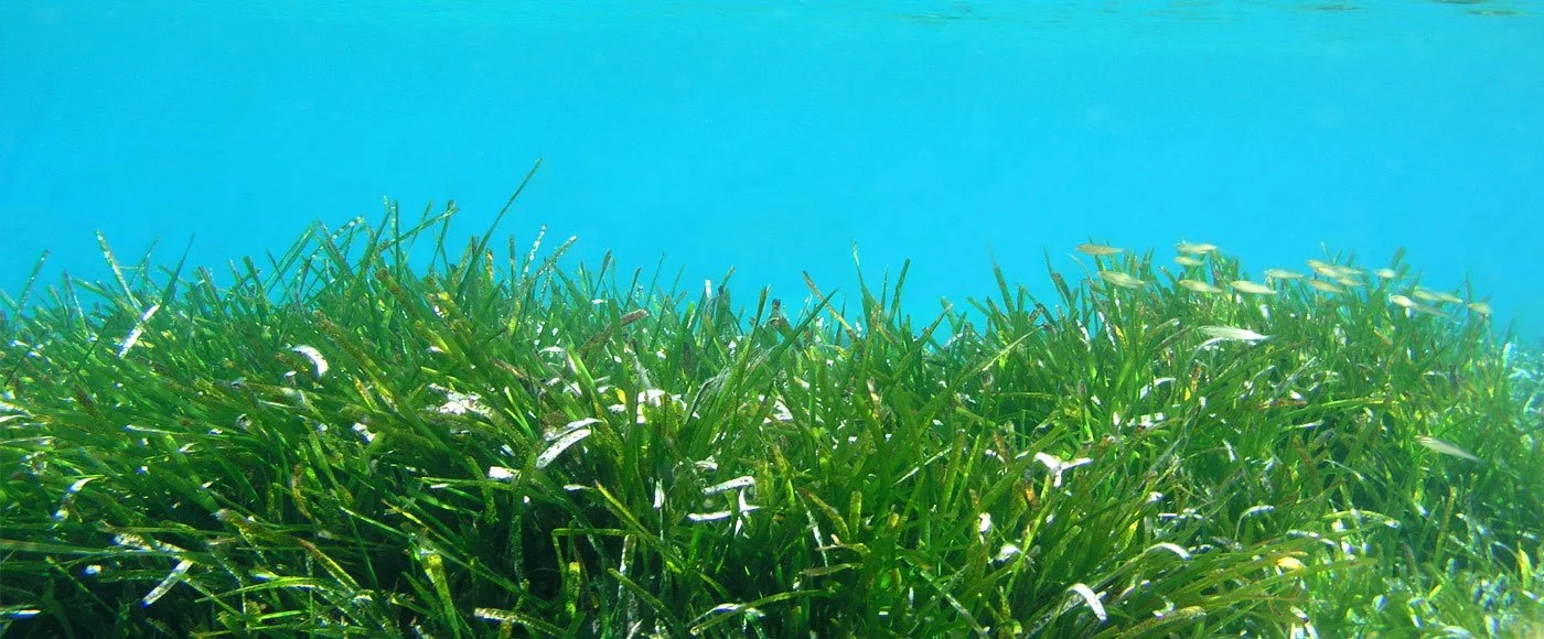
Photo credit: Project Watershed
Example
The K’omoks Estuary — A Blue Carbon Pilot Project
The K’omoks Estuary is located on the east coast of Vancouver Island and is made up of salt marsh and eelgrass meadows [50]. These ecosystems sequester large amounts of carbon through photosynthesis, with much of the carbon stored in the sediment below the plants [51]. The estuary has been affected by urban development, logging, dredging, agriculture, mining, and increasing storm frequency [52].
Led by the Squamish River Watershed Society and the Comox Valley Project Watershed Society, the project aimed to restore the K’ómoks Estuary and to develop an applicable protocol for the communities of the Pacific coast [53]. The project began with the mapping of 23 hectares of salt marsh and 164 hectares of eelgrass meadows. Based on the mapping, the team has estimated that the estuaries could sequester as much as 57tCO₂e per year.
The project has successfully restored the salt marsh and eelgrass habitat by constructing “barrier islands” and planting more than 500 square metres of native salt marsh plants and 6,300 square metres of eelgrass, helping to strengthen the K’ómoks Estuary’s critical function as a carbon sink and wildlife habitat.
Partners:
Squamish River Watershed Society (SRWS)
Comox Valley Project Watershed Society
University of Toronto and North Island College
K’ómoks First Nation
Known Funder:
North American Partnership for Environmental Community Action (NAPECA)
-
[31] Bradshaw, C.J. and Warkentin, I.G., (2015). Global estimates of boreal forest carbon stocks and flux. Global and Planetary Change, 128, 24-30.
[35] PPeng, L., Searchinger, T.D., Zionts, J. and Waite, R., (2023). The carbon costs of global wood harvests. Nature, 620(7972), 110-115.
[33] enayas, J.M.R., Newton, A.C., Diaz, A. and Bullock, J.M., (2009). Enhancement of biodiversity and ecosystem services by ecological restoration: a meta-analysis. science, 325(5944), 1121-1124.
Herbeck, L.A. and Larsen, D.R., 1999. Plethodontid salamander response to silvicultural practices in Missouri Ozark forests. Conservation Biology, 13(3), pp.623-632.
Lesica, P., McCune, B., Cooper, S.V. and Hong, W.S., 1991. Differences in lichen and bryophyte communities between old-growth and managed second-growth forests in the Swan Valley, Montana. Canadian Journal of Botany, 69(8), pp.1745-1755.
Lindenmayer, D.B., Westgate, M.J., Scheele, B.C., Foster, C.N. and Blair, D.P., 2019. Key perspectives on early successional forests subject to stand-replacing disturbances. Forest Ecology and Management, 454, p.117656.
Miller, K.M., McGill, B.J., Mitchell, B.R., Comiskey, J., Dieffenbach, F.W., Matthews, E.R., Perles, S.J., Schmit, J.P. and Weed, A.S., 2018. Eastern national parks protect greater tree species diversity than unprotected matrix forests. Forest Ecology and Management, 414, pp.74-84.
Thom, D., Golivets, M., Edling, L., Meigs, G.W., Gourevitch, J.D., Sonter, L.J., Galford, G.L. and Keeton, W.S., 2019. The climate sensitivity of carbon, timber, and species richness covaries with forest age in boreal–temperate North America. Global Change Biology, 25(7), pp.2446-2458.
Watson, J.E., Evans, T., Venter, O., Williams, B., Tulloch, A., Stewart, C., Thompson, I., Ray, J.C., Murray, K., Salazar, A. and McAlpine, C., 2018. The exceptional value of intact forest ecosystems. Nature ecology & evolution, 2(4), pp.599-610.
Zlonis, E.J. and Niemi, G.J., 2014. Avian communities of managed and wilderness hemiboreal forests. Forest Ecology and Management, 328, pp.26-34.
[34] Burrascano, S., Keeton, W.S., Sabatini, F.M. and Blasi, C., (2013). Commonality and variability in the structural attributes of moist temperate old-growth forests: A global review. Forest Ecology and Management, 291, pp.458-479.
Cairns, M.A. and Meganck, R.A., 1994. Carbon sequestration, biological diversity, and sustainable development: integrated forest management. Environmental management, 18(1), pp.13-22.
Federici, S., Lee, D. and Herold, M., 2017. Forest mitigation: A permanent contribution to the paris agreement. WorNing Pap, pp.1-24.
Harmon, M.E., Ferrell, W.K. and Franklin, J.F., 1990. Effects on carbon storage of conversion of old-growth forests to young forests. Science, 247(4943), pp.699-702.
Keith, H., Lindenmayer, D., Macintosh, A. and Mackey, B., 2015. Under what circumstances do wood products from native forests benefit climate change mitigation?. PLoS One, 10(10), p.e0139640.
Keith, H., Vardon, M., Stein, J.A., Stein, J.L. and Lindenmayer, D., 2017. Ecosystem accounts define explicit and spatial trade-offs for managing natural resources. Nature Ecology & Evolution, 1(11), pp.1683-1692.
Lafleur, B., Fenton, N.J., Simard, M., Leduc, A., Paré, D., Valeria, O. and Bergeron, Y., 2018. Ecosystem management in paludified boreal forests: enhancing wood production, biodiversity, and carbon sequestration at the landscape level. Forest Ecosystems, 5, pp.1-14.
Mackey, B., Prentice, I.C., Steffen, W., House, J.I., Lindenmayer, D., Keith, H. and Berry, S., 2013. Untangling the confusion around land carbon science and climate change mitigation policy. Nature climate change, 3(6), pp.552-557.
Nunery, J.S. and Keeton, W.S., 2010. Forest carbon storage in the northeastern United States: net effects of harvesting frequency, post-harvest retention, and wood products. Forest Ecology and management, 259(8), pp.1363-1375.
Watson, J.E., Evans, T., Venter, O., Williams, B., Tulloch, A., Stewart, C., Thompson, I., Ray, J.C., Murray, K., Salazar, A. and McAlpine, C., 2018. The exceptional value of intact forest ecosystems. Nature ecology & evolution, 2(4), pp.599-610.
[35] McNicol, G., Bulmer, C., D’Amore, D., Sanborn, P., Saunders, S., Giesbrecht, I., Arriola, S.G., Bidlack, A., Butman, D. and Buma, B., (2019). Large, climate-sensitive soil carbon stocks mapped with pedology-informed machine learning in the North Pacific coastal temperate rainforest. Environmental Research Letters, 14(1), 014004.
[36] Lafleur, B., Fenton, N.J., Simard, M., Leduc, A., Paré, D., Valeria, O. and Bergeron, Y., (2018). Ecosystem management in paludified boreal forests: enhancing wood production, biodiversity, and carbon sequestration at the landscape level. Forest Ecosystems, 5, 1-14.
Liski, J., Ilvesniemi, H., Mäkelä, A.A. and Starr, M., (1998). Model analysis of the effects of soil age, fires and harvesting on the carbon storage of boreal forest soils. European Journal of Soil Science, 49(3), pp.407-416.
Jiang, H., Apps, M.J., Peng, C., Zhang, Y. and Liu, J., 2002. Modelling the influence of harvesting on Chinese boreal forest carbon dynamics. Forest Ecology and Management, 169(1-2), pp.65-82.
Seedre, M., Taylor, A.R., Brassard, B.W., Chen, H.Y. and Jõgiste, K., 2014. Recovery of ecosystem carbon stocks in young boreal forests: a comparison of harvesting and wildfire disturbance. Ecosystems, 17, pp.851-863.
[37] Buchholz, T., Friedland, A.J., Hornig, C.E., Keeton, W.S., Zanchi, G. and Nunery, J., (2014). Mineral soil carbon fluxes in forests and implications for carbon balance assessments. Gcb Bioenergy, 6(4), 305-311.
Hume, A.M., Chen, H.Y. and Taylor, A.R., 2018. Intensive forest harvesting increases susceptibility of northern forest soils to carbon, nitrogen and phosphorus loss. Journal of Applied Ecology, 55(1), pp.246-255.
Mayer, M., Prescott, C.E., Abaker, W.E., Augusto, L., Cécillon, L., Ferreira, G.W., James, J., Jandl, R., Katzensteiner, K., Laclau, J.P. and Laganière, J., 2020. Tamm Review: Influence of forest management activities on soil organic carbon stocks: A knowledge synthesis. Forest Ecology and Management, 466, p.118127.
James, J. and Harrison, R., 2016. The effect of harvest on forest soil carbon: A meta-analysis. Forests 7: 308.
Rab, M.A., 2004. Recovery of soil physical properties from compaction and soil profile disturbance caused by logging of native forest in Victorian Central Highlands, Australia. Forest Ecology and Management, 191(1-3), pp.329-340.Forest Ecology and Management, 191(1-3), pp.329-340.
Zummo, L.M. and Friedland, A.J., 2011. Soil carbon release along a gradient of physical disturbance in a harvested northern hardwood forest. Forest Ecology and Management, 261(6), pp.1016-1026.
[38] Bradshaw, C.J. and Warkentin, I.G., (2015). Global estimates of boreal forest carbon stocks and flux. Global and Planetary Change, 128, 24-30.
Deluca, T.H. and Boisvenue, C., 2012. Boreal forest soil carbon: distribution, function and modelling. Forestry, 85(2), pp.161-184.
Lafleur, B., Fenton, N.J., Simard, M., Leduc, A., Paré, D., Valeria, O. and Bergeron, Y., 2018. Ecosystem management in paludified boreal forests: enhancing wood production, biodiversity, and carbon sequestration at the landscape level. Forest Ecosystems, 5, pp.1-14.
Walker, W.S., Gorelik, S.R., Baccini, A., Aragon-Osejo, J.L., Josse, C., Meyer, C., Macedo, M.N., Augusto, C., Rios, S., Katan, T. and de Souza, A.A., 2020. The role of forest conversion, degradation, and disturbance in the carbon dynamics of Amazon indigenous territories and protected areas. Proceedings of the National Academy of Sciences, 117(6), pp.3015-3025.
[39] Nature Conservancy, (2025). Available from: https://www.natureconservancy.ca/assets/documents/nat/Grasslands-infographic_EN.pdf
[40] Canadian Permafrost Association. (2025). Permafrost 101. Available from https://canadianpermafrostassociation.ca/What-is-Permafrost.htm)
[41] National Snow and Ice Data Centre, (2025). Available from: https://nsidc.org/home
[42] Canadian Permafrost Association, (2025). Permafrost 101. Available from: https://canadianpermafrostassociation.ca/What-is-Permafrost.htm
[43] [46] Government of Canada, 2024. Active Layer – Quttinirpaaq. Available from: https://open.canada.ca/data/en/dataset/5e8d13ca-2af8-4335-b770-20b898a5b530
[44] [45] Schuur, T., and Hugelius, G. 2016. Terrestrial carbon cycle. Arctic Report Card 2016, J. Richter-Menge, J. E. Overland, and J. Mathis, Eds. Available from: www.arctic.noaa.gov/Report-Card.
[47] Wilfrid Laurier University, Dehcho Collaborative on Permafrost (DCoP). Available from: www.wlu.ca/academics/research/partnerships/gnwt/stories/resources/2024/dehcho-collaborative-on-permafrost.html
[48] International Union for Conservation of Nature. (2025). Blue carbon. https://iucn.org/resources/issues-brief/blue-carbon
[49] National Oceanic and Atmospheric Administration, 2025. Available from: https://oceanservice.noaa.gov/ecosystems/coastal-blue-carbon/#:~:text=Their%20plants%20usually%20grow%20a,of%20years%20(carbon%20storage)
[50] Hodgson, C., Spooner, A., 2016. The K’ómoks and Squamish Estuaries: A Blue Carbon Pilot Project Final Report to North American Partnership for Environmental Community Action (NAPECA) Grant 2014-1362. Available from: https://projectwatershed.ca/2016/07/27/project-watershed-blue-carbon-report-accepted-by-cec/
[51]Squamish River Watershed Society, 2025 Sḵwx̱wú7mesh/Squamish River Estuary. Available from: https://www.squamishwatershed.com/blue-carbon-project.html#
[52] [53] Hodgson, C., Spooner, A., 2016. The K’ómoks and Squamish Estuaries: A Blue Carbon Pilot Project Final Report to North American Partnership for Environmental Community Action (NAPECA) Grant 2014-1362. Available from: projectwatershed.ca/2016/07/27/project-watershed-blue-carbon-report-accepted-by-cec/